Add an imageAdd albumRSS

Photo Gallery

Photo Gallery » Scheldt River Flood Hazard Maps
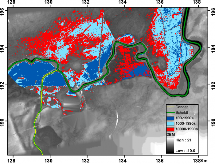
Flood hazard map 1990s
Description Flood hazard maps (1990s) for return periods of 100, 1000 and 10000 years, for the Dendermonde area at the Scheldt – Dender confluence. Author: Victor Ntegeka, Patrick Willems, Jaak Monbaliu PNG file - 351.03 kB - 1 411 x 1 082 pixels added on 2012-06-15381 views Creative Commons License This work is licensed under a Creative Commons Attribution-Noncommercial-Share Alike 4.0 License
Click here to return to the thumbnails overview
EU logo

THESEUS is funded by the European Commission within FP7-THEME 6 - Environment, including climate.
Grant 244104
1 December 2009 - 30 November 2013
Website developed and maintained by VLIZ

7 logo