Skip to main content
NL
EN
Home
About
Tutorial
Image library
»
6. Geometric accuracy maps
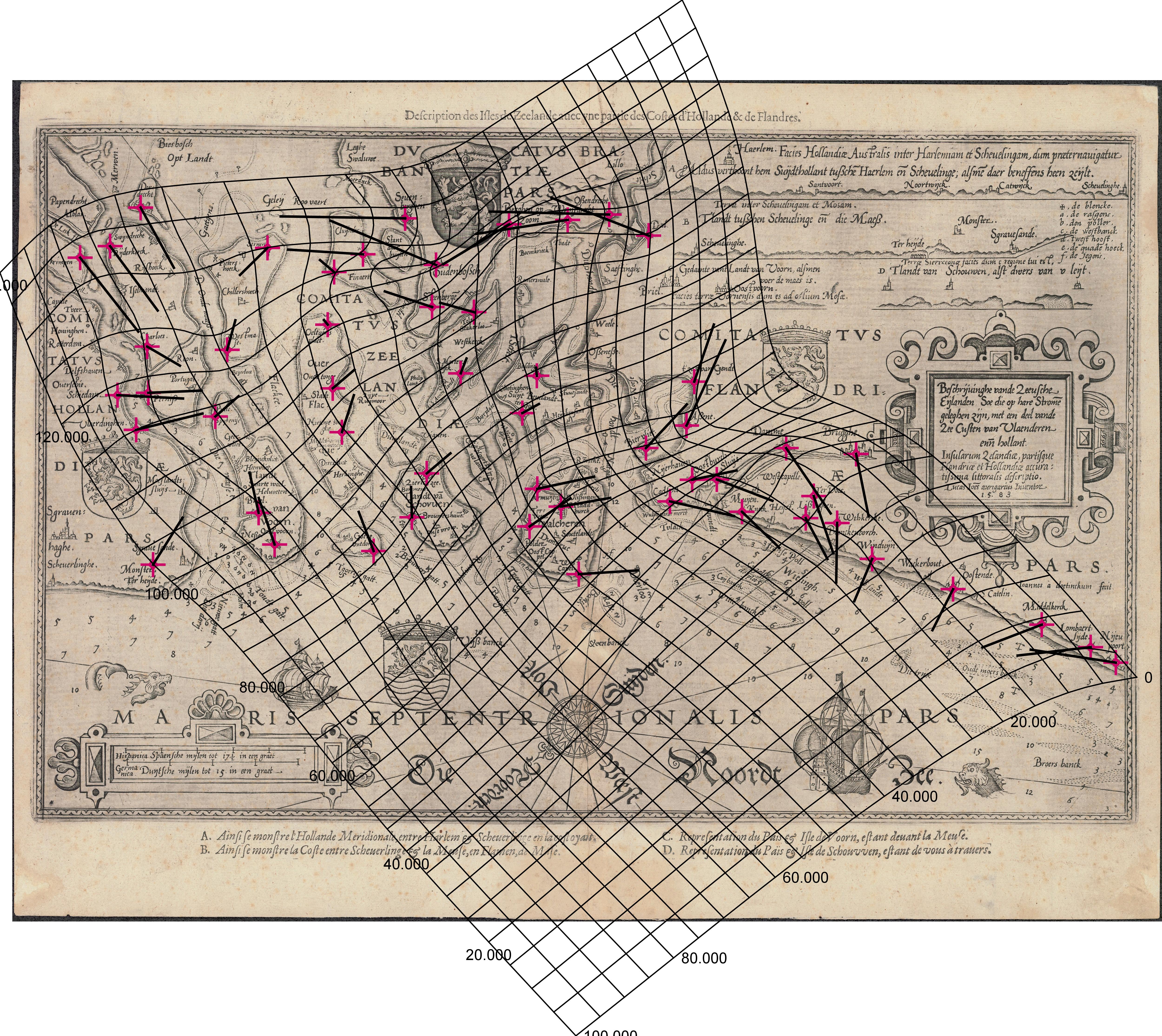
Beschrijvinghe vande Zeeusche Eijlanden Soe die op hare Stromen geleghen zijn, met een deel vande Zee Custen van Vlaenderen ende hollant. Insularum Zelandiae, partisque Flandriae et Hollandiae accuratissima littoralis descriptio (1583)
Description
The distortion grid and the displacement vectors provide a representation of the geometric accuracy of the map and were generated using MapAnalyst (
Jenny & Hurni 2011
).
Author
Waghenaer, Lucas Jansz (1583)
JPG file
- 4.35 MB
- 5 000 x 4 460 pixels
added on 2016-03-18
515 views
Map based on
Jenny, B.; Hurni, L. (2011). Studying cartographic herita...
Download full size
This work is licensed under a
Creative Commons Attribution-NonCommercial-ShareAlike 4.0 International
License
Click
here
to return to the thumbnails overview
Scroll To Top