News

Final meeting at Royal Belgian Institute of Natural Sciences, Brussels. (19 June 2018)
We would highly appreciate your input during the interactive session on future prospects of the datasets, your experiences with historic data and long-term change detection, and finally your opinions on policy decisions related to monitoring procedures.
Participation is free and open to everyone, but please register before 5 June: rlagring@naturalsciences.be (subject: 4DEMON Registration).
When: Tuesday 19 June 2018, 9:30-13h
Where: RBINS Museum, Vautierstreet 29, 1000 Brussels, VIP Room
Third annual meeting of our BRAIN project
Highlights:
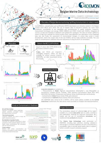
§ The data management team is now developing the central data portal, where all data stored in different databases (ie. at BMDC and VLIZ), will be made publicly accessible. This is a pilot for both data centers.
§ Contaminants in biota and sediment (ILVO and BMDC)
The average of Fe and Al values will be used for normalization on sediment fraction. Principal Component Analyses and Spatial clustering analyses on normalized data show that Cd and Hg concentrations are linked and behave more closely to PCBs than to others heavy metals.
§ Eutrophication: Remote Sensing (REMSEM and MUMM)
Spatial patterns of Chl a variability in the Belgian waters (BCZ) result in seven classes, which look directly linked to the bathymetry and other physical parameters (eg. fronts). First results show the influence of nutrient input from the Scheldt and Atlantic waters, maximum turbidity, nutrients and chl a concentrations close to the coast, higher Chl a concentrations with higher turbidity in the BCZ, and earlier starting of the Chl a bloom in the west and later in the north-east.
§ Phytoplankton dynamics and species composition (UGent and VLIZ)
The General Additive Mixed Modelling method is applied to study the spatiotemporal evolution of diatom and dinoflagellate abundances in two periods (1970-1978 and 1995-2011), which finally result in four separate models.
§ Ocean acidification (ULg and BMDC)
There is a clear relation between pH and eutrophication, ocean acidification (increase CO2 in air), S-N atmospheric deposition and oligotrophication. The compiled datasets of pH show the seasonal dynamics of high pH in summer versus low pH in winter. Plotted time trends indicate a link to the stop of land-input of phosphates in the end of the ‘80s. An overall decrease in methane concentrations, salinity, temperature and wind speed is observed in the BCZ. It should be studied whether this is related to long-term climate changes.
4DEMON at IODE XXIV (27-31 March 2017)
On this one-day workshop, we presented a poster on 4DEMON, which was well received.
Link to PDF
Link to JPG
4DEMON at International Conference on Marine Data and Information Systems in Gdansk (Poland)

See the IMDIS2016 website for the full programme and presentations.
Links to the abstract & posters:
16th VLIZ Marine Scientist Day
The PDF version of this poster can be downloaded here.
(All pictures by VLIZ (Reynaert, Stefanie))

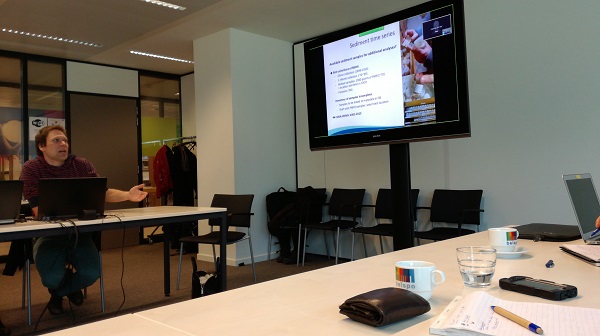
4DEMON Workshop on data analysis on January 26th 2016
WP3 Contamination: need for normalization of pollutant concentrations
In order to determine temporal or spatial changes in pollutant concentrations in sediments, a correction is needed for the grain size effect. In fact, coarse components in sediments (which normally have low levels of heavy metals and organic pollutants) produce a downward shift of the concentration in the total sample. Since sediments of different origin vary in grain size composition, this shift in non-uniform between locations. Therefore, pollutant concentrations should be normalized. One way of doing this is normalizing all data towards a “standard seafloor”.
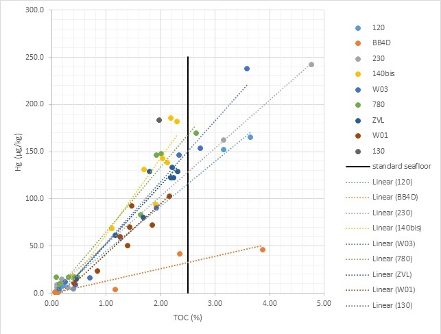
The figure above shows the relation between the concentration of the contaminant Hg and the normalizing parameter (TOC in this example) on different locations on the Belgian Part of the North Sea. For each location, different grain size compositions were analyzed for Hg concentration and for TOC. In this way, the concentration of Hg for each location can be standardized towards the standard seafloor (which contains 2.5% TOC) and results can be compared between each other.
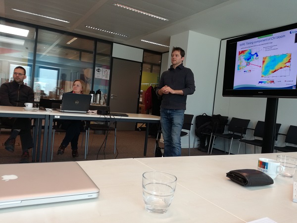
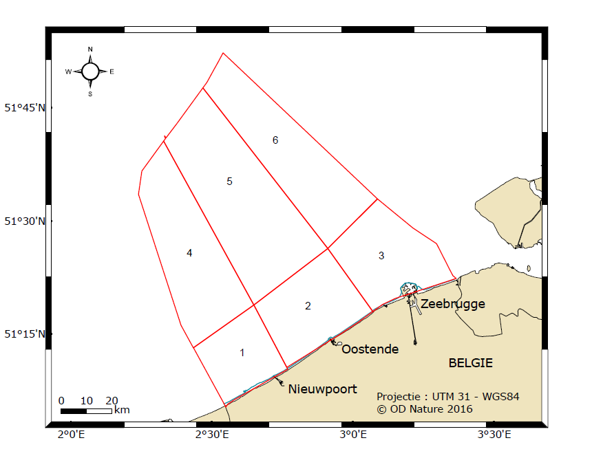
WP4 Eutrophication: zonation of the BCZ
For the statistical analysis and to investigate spatial and temporal variations in the phytoplankton composition and dynamics, it was decided to divide the BCP into 6 zones (see Figure below). Zonation was based on a ‘common sense’ approach in order to cover as much as possible geomorphological (e.g. the inshore-offshore depth gradient) and environmental (e.g. the impact of the Scheldt river plume on water turbidity and nutrient concentrations) gradients in the BCP. The study in variations of CHL dynamics in the BCP between different pixels observed in the Earth Observation supports the chosen zonation.
The results on data analysis for WP4 will be presented by Anja Nohe on the 16th VLIZ Marine Scientist Day (see poster above).
Two main trends were observed:
- An upward trend can be observed on the dinoflagellate/diatom abundance ratio for the last decade; higher ratios are also observed during summer months
- A shift in genera composition between 1970s and 2000s
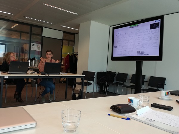
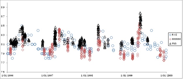
WP5 Ocean acidification: seasonal pH variations in the Belgian Coastal Zone
The analysis of pH data shows seasonal variations that seems consistent with the biological activity (see Figure).
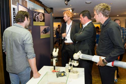
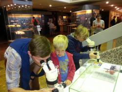
World Ocean Day at the Museum on Sunday 7th of June 2015
On the Blue Market, visitors could have a closer look to a seawater sample through stereo microscopes presenting a view on the foam-forming phytoplankton species Phaeocystis, some diatoms and copepods. Historic reports containing data were presented and very young scientists were contributing to data rescue by typing historic data.
Marine Environmental Monitoring, Modelling and Prediction, Liège colloquium 4-8th May, 2015
'Challenges to combine 40 years of marine contamination data within 4DEMON' was presented as a poster by J. Gauquie (ILVO).
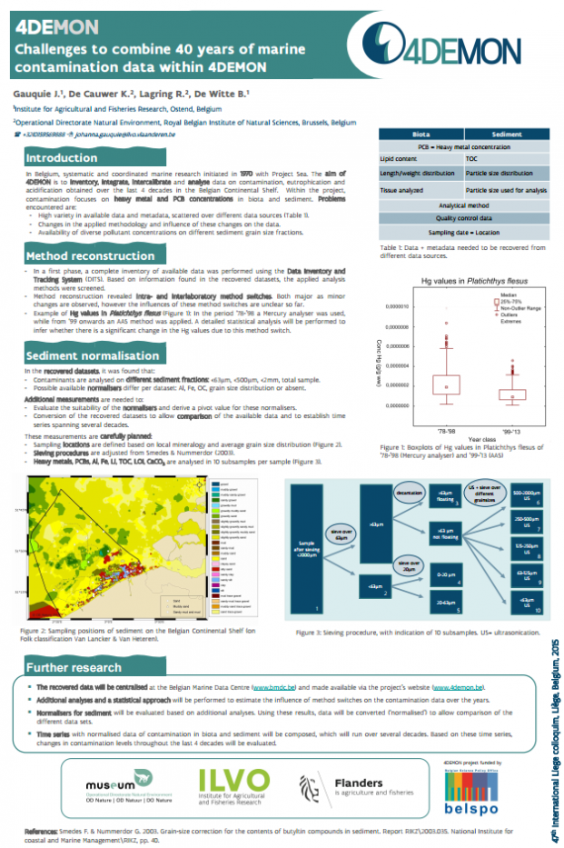
Download the pdf (689KB)

Sediment sampling on the Belgica in March 2015
Over the years, contaminants on sediment have been measured in different ways. For example, in the seventies the whole sample was measured while nowadays measurements take place only on the small fraction (
Additional sediment samples are collected during the Belgica cruise 2015/06 to perform analyses on different grain size fractions. These measurements will be used to test the best conversion allowing us to compare the pollution level over the years.
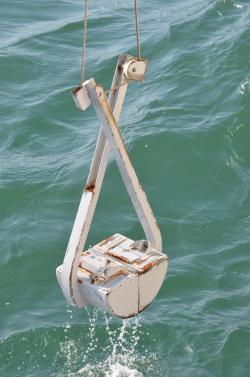
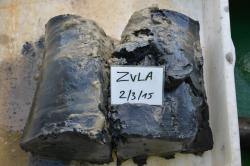
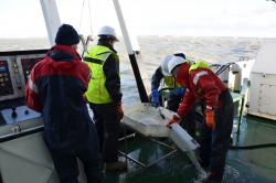
(Copyright: Hans Hillewaert)
4DEMON at the Scientific Conference for the 10th Anniversary of the IOC Project Office for IODE opening
on the occasion of the 10th Anniversary of the opening of the IOC Project Office for IODE in Ostend, 16 March 2015.
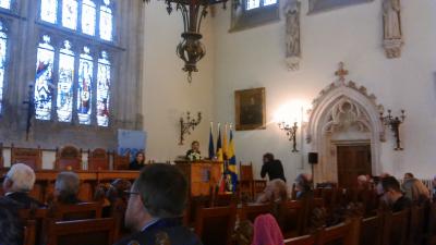
IODE-XXIII
during the 23rd Session of the IOC Committee on International Oceanographic Data and Information Exchange (IODE-XXIII) held in Bruges
Download the pdf (1MB)
VLIZ young scientist day 2015
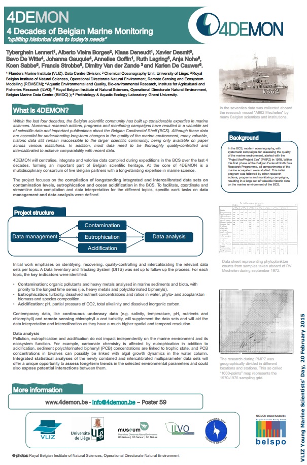
1. 4DEMON - 4 Decades of Belgian Marine Monitoring, by Lennert Tyberghein (VLIZ) [PDF, 734 KB]
2. Phytoplankton composition and biomass changes during the last four decades in the Belgian Coastal Zone, by Anja Nohe (UGent)
4DEMON Follow Up Meeting
Vice versa we were happy to hear their suggestions. So far, 881 historic data sources, ranging from cruise reports to original data listings, have been inventorised. Several of these have already been digitized.
The 4DEMON project is well on its way rescuing historical marine data!
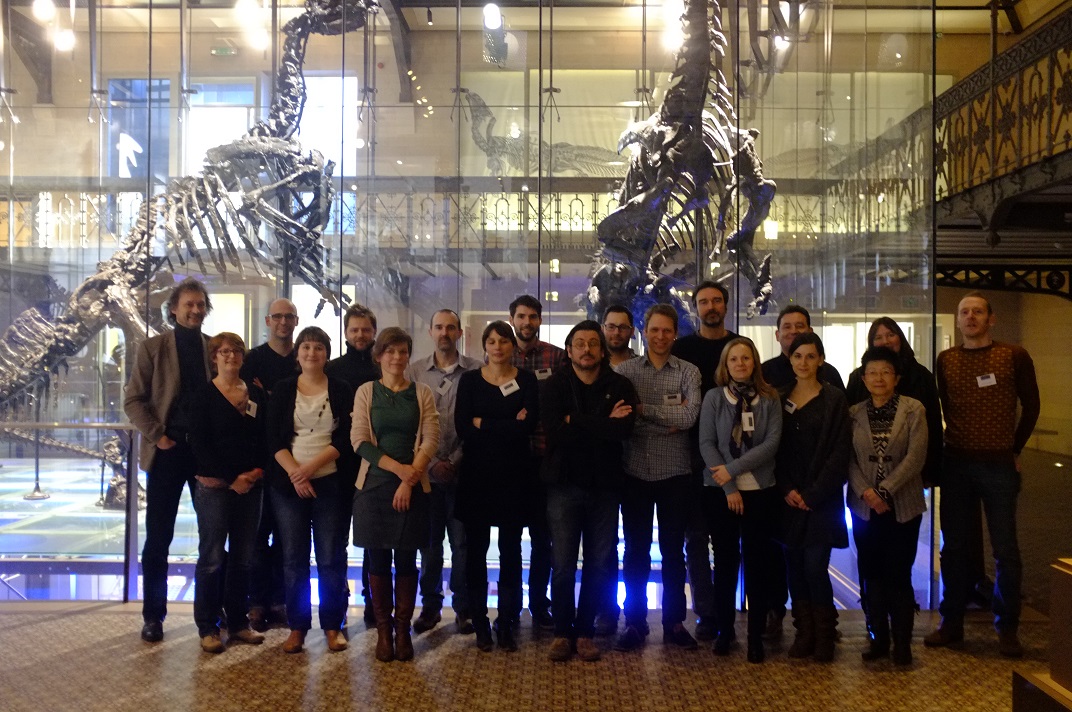
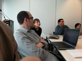
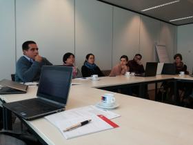
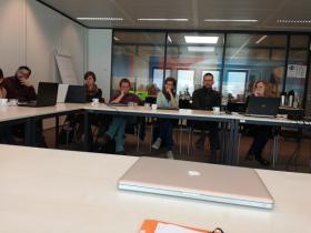
In front of the iguanodon skeletons in the Dinosaur Gallery
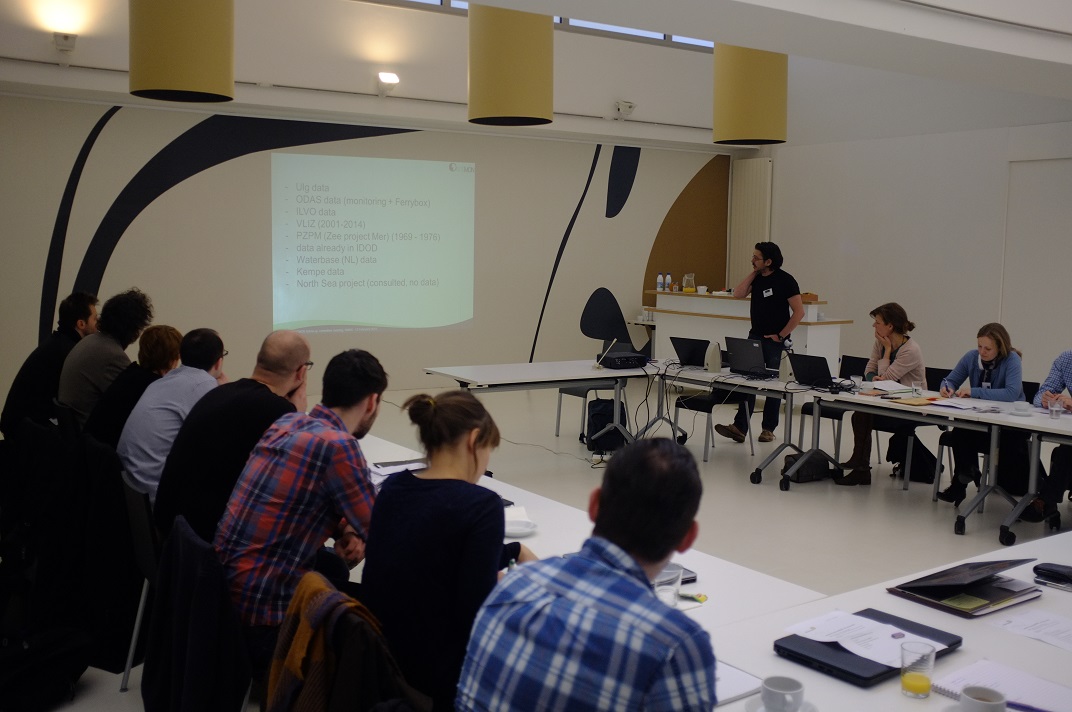
Everybody around the table, during the meeting
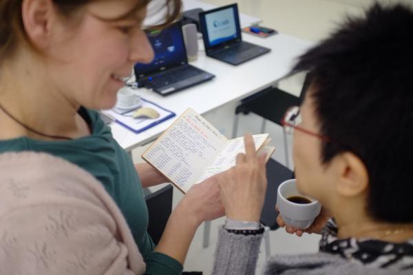
K. De Cauwer (BMDC) and L. Chou (ULB) looking into a notebook with data.
DITS launch and use
DITS, the Data Inventory and Tracking System, has been launched on 15 September 2014.
This web application allows users and data managers to inventorise data sources, submit new data, identify missing data and track the import status. It also features several ways to explore the data (datasources, projects, services, platforms...) that are in the system.
More than 800 data sources, like historic technical reports, cruise reports, maps and publications have already been scanned and uploaded in the frame of 4DEMON.
Website URL: dits.bmdc.be
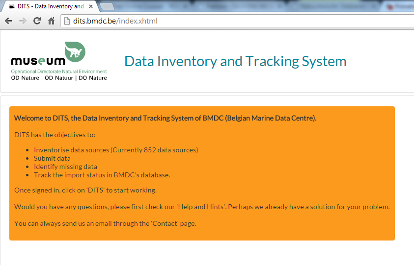
A close-up screenshot of the DITS homepage
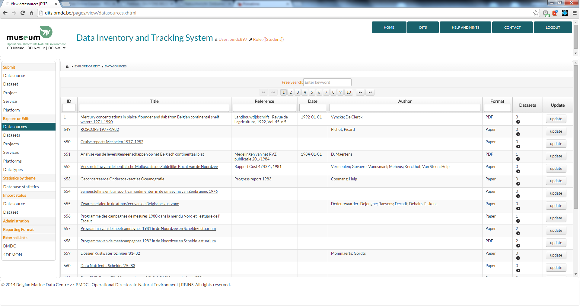
A screenshot of the datasources inventory page, after login by registered users
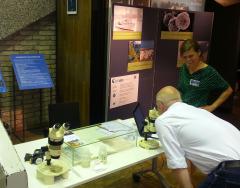
Lab visit by BMDC
Valuable and detailed information was encountered with in particular the original heavy metal results on sediment measured in 1973 on the 1000 points in the North Sea in the frame of 'Projekt Zee/Projet Mer' (14/07/2014).
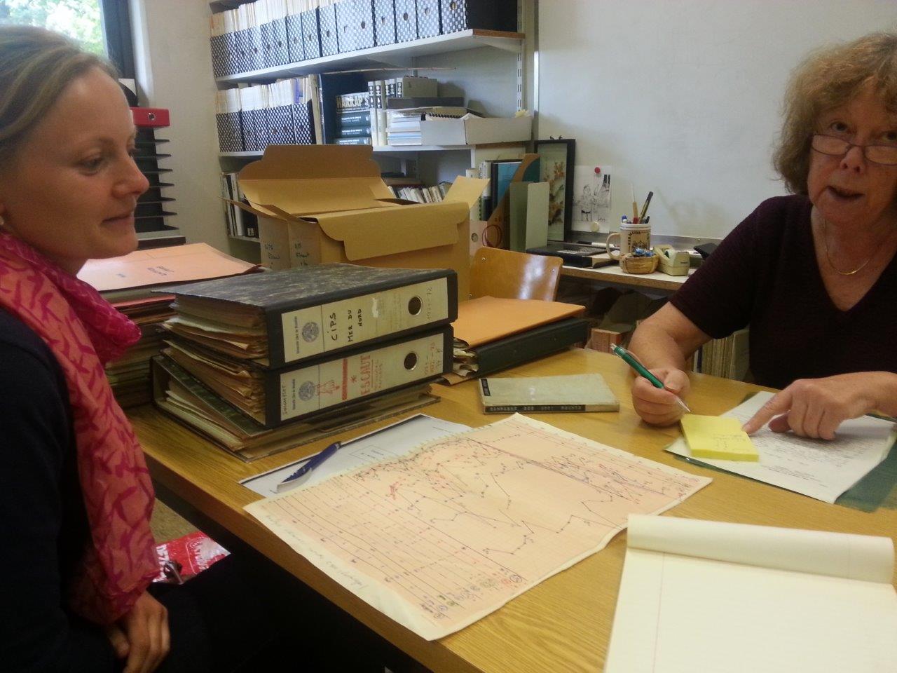
At the lab with Michèle Loijens (right)
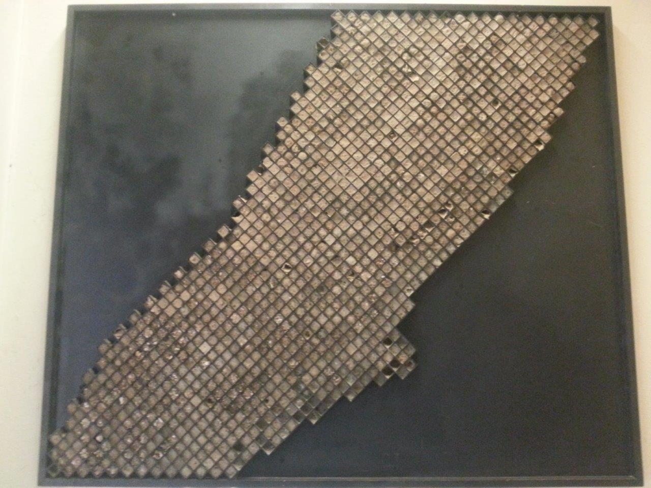
Scientific artwork of the Map of the 1000-points filled with sediment
collected in the seventies during 'Projekt Zee/Projet Mer'