Phytoplankton bloom
MODIS ocean colour image
Foam on the beach: A natural phenomenon?
Monitoring the earth oceans from space
![]()


")
- Introduction
What is remote sensing? Why do we use remote sensing?
Can you imagine how satellite images could be used?
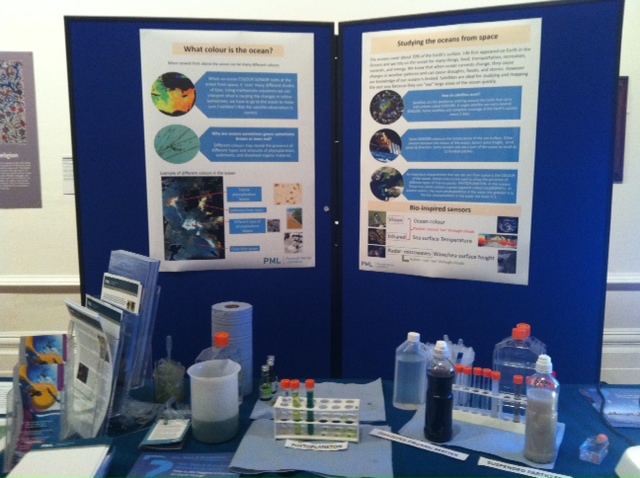
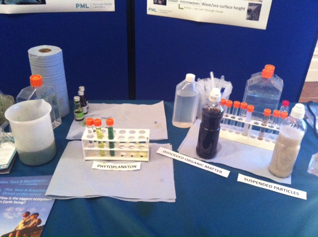
What is Ocean Colour?
Satellites used in remote sensing are an important tool for scientists when observing the Earth. It can provide a wide visual picture and allows us to create more insight into the eutrophication processes by studying Ocean Colour (OC). - Experiment
In the first part of this activity you will study some satellite images and try to identify their origin. In the second part you will perform a simple Ocean Colour experiment to demonstrate how changing concentrations of phytoplankton, dissolved organic matter or suspended particles can have an influence on the colour of the ocean.
- This tool is designed for children from 7-11 years old.
Download (PDF) here!
 |
 |
 |
|
|
 |
||
|
Part-financed by ERDF through the Interreg IV A 2 Seas Programme “Investing in your Future”
“The document reflects the author's views. The INTERREG IVA 2 Seas Programme Authorities are not liable for any use that may be made of the information contained therein.” Website developed and maintained by VLIZ Subscribe This email address is being protected from spambots. You need JavaScript enabled to view it. to receive the ISECA newsletter by email |
|||||||